Jordan
Generation Output
1966.53cfs
Lake Level*
251.48
Generators
1

Spillway Conditions
0ft3/sec
*Lake elevations are always subject to change, depending on conditions. Individuals who recreate below our dams and those with boats and water-related equipment on our lakes and facilities should always stay alert to changing conditions and be prepared to take the necessary steps to protect their property.
Ever wondered why the water at your favorite lake is often higher or lower than when you last visited?
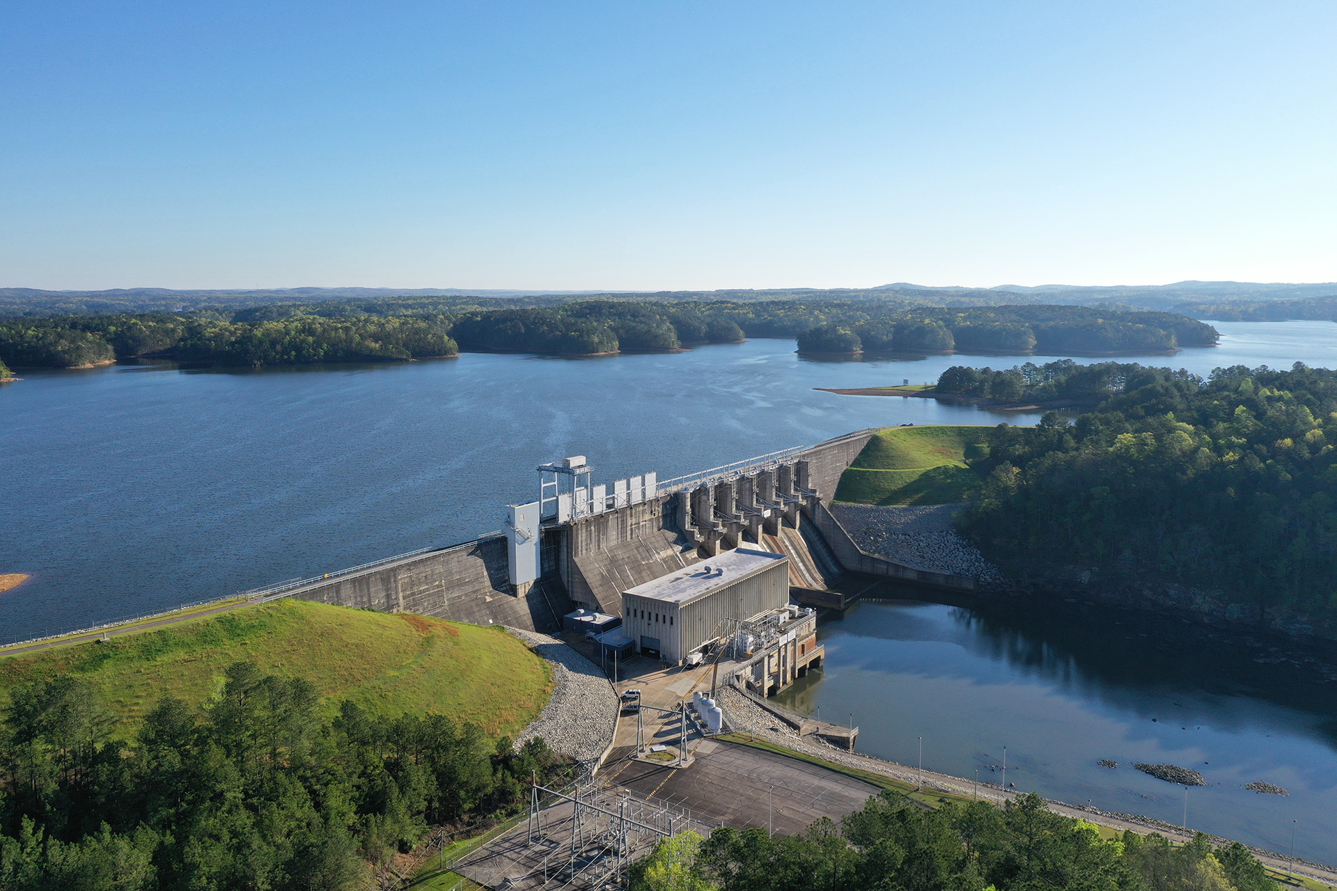
Alabama Power operates two kinds of lakes: 1) Run of River, and 2) Storage. Lay, Mitchell and Jordan lakes on the Coosa River, Yates and Thurlow lakes on the Tallapoosa River, and Bankhead and Holt lakes (owned by the U.S. Army Corps of Engineers) on the Warrior River are called “run-of-river” projects that discharge essentially the same amount of water that flows into them. This type of operation gives them a fairly consistent lake level year round. These lakes were not designed with flood control as a specific project purpose. Alternatively, “storage” projects like Weiss, Henry, and Logan Martin lakes on the Coosa River, Harris and Martin lakes on the Tallapoosa River, and Smith lake on the Warrior (Sipsey) River provide seasonal storage, having different summer and winter pool levels, and are drawn down late fall into the winter to provide a means of managing and storing winter/spring rains. These operations provide a measure of protection against downstream flooding during high flow events. These storage projects normally have their levels returned to summer pool levels during the spring timeframe. Water stored in these storage lakes can also help mitigate some impacts of drought by providing a limited source of water for use when it is scarce, such as during drought periods.
The need for water in summer and fall can often exceed the natural supply. Most big lakes also operate for many other reasons — hydropower, recreation, navigation and the environment. Each of these purposes can factor into whether water is released, causing a fall in lake levels particularly during the late summer and fall periods.
Floods are normally the cause of the greatest and quickest changes in lake levels. Heavy rains produce floods that can raise a lake level several feet overnight. When floods are over, it is important to get the lake ready to store water from the next flood that may come along, and that is done by returning the lake to its normal level.
Operating Guide
The Federal Energy Regulatory Commission along with the U.S. Army Corps of Engineers help determine the operating curves, called a Guide, for the storage lakes managed by Alabama Power, which is the maximum elevation at which Alabama Power may maintain the reservoir under normal conditions. The operating Guide begins in January at a winter pool elevation and then rises during the late winter into early spring to summer pool elevation. The Guide remains the same throughout the summer months, which supports recreation use on the lakes. In fall and early winter, the Guide declines to make room for normal winter and spring flood flows. In general, the operating guide provides the guidance needed for both flood control operations and daily water management decisions.
Lake Conditions
Jordan spillway release is 0 cfs. Total discharge is 2119 cfs. Lake elevations are always subject to change, depending on conditions.Special Operations
Individuals that recreate below our dams and those with boats and water-related equipment and facilities on our lakes should always stay alert to changing conditions and be prepared to take the necessary steps to protect their property.Seasonal Level Data

Tentative Operating Schedules
| Start Time | Generators |
|---|---|
| 12:00 AM | 1 |
| Start Time | Generators |
|---|---|
| 12:00 AM | 1 |
| Start Time | Generators |
|---|---|
| 12:00 AM | 1 |
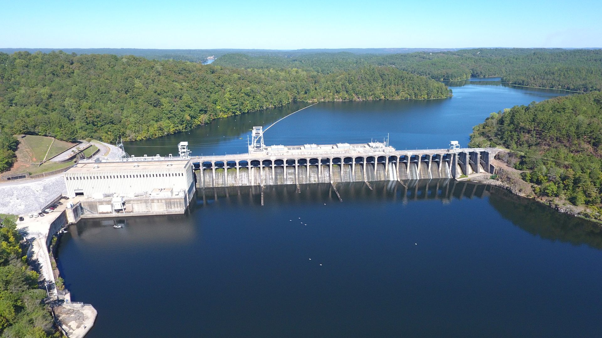
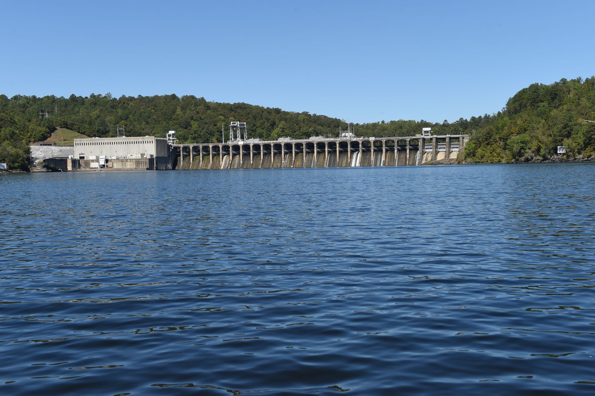
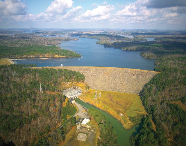
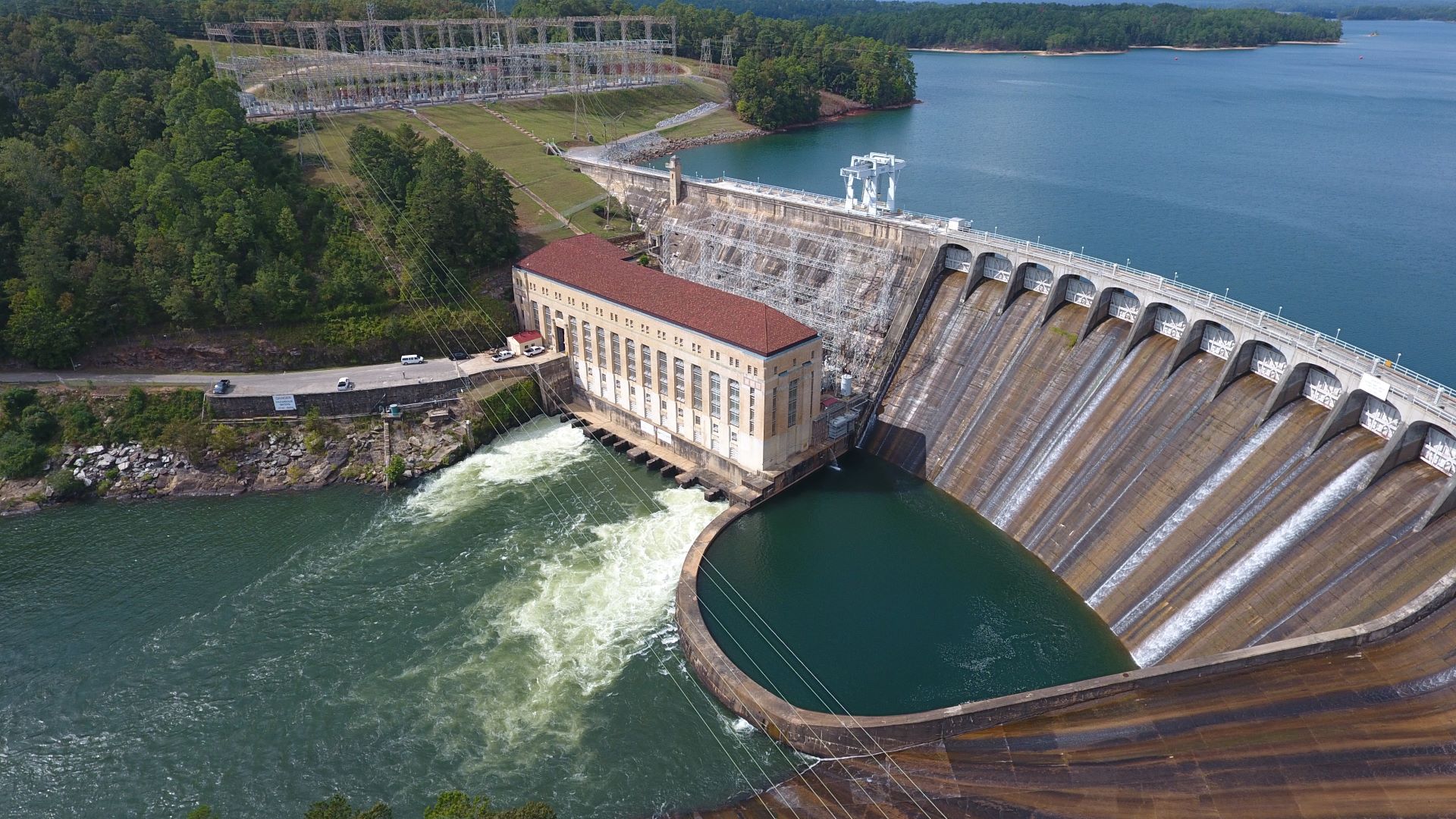
Jordan
The wildest stretch of the Coosa River began about 14 miles north of Wetumpka and ended at the bridge that linked the two sides of town. So great were the falls and standing waves that you could hear the water roar a mile from the stream. “Devil’s Staircase,” as it was known, is where Jordan Dam would be completed in 1928.
Forty years later, a second dam was constructed on Jordan Lake, Walter Bouldin Dam. Bouldin Dam has the largest generating capacity of Alabama Power’s hydro facilities and is unusual in design because it was built on a canal.
Elevation above sea level: 252 feet
Drop Area: 6,800 acres
Shoreline: 118 miles
Length: 18.4 miles
Maximum depth at dam: 110 feet
Area of watershed draining into reservoir: 10,165 square miles
InIn service: 12/31/1928
Capacity: Four generators rating 25,000 kilowatts each
Type: Gravity concrete
Length: 2,066 feet
Maximum height: 125 feet
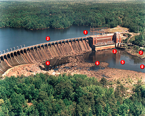
- Swirling water and strong underwater currents at powerhouse intakes.
- Strong unpredictable currents, presence of submerged hazards and low visibility upstream of dam spillways and trash gates.
- Turbulent discharges from automatically operated turbines.
- Cascading spillway discharges, strong unpredictable currents below dam and presence of debris passing over or through dam.
- Strong upstream currents in surface waters (reverse flow).
- Swift, turbulent waters below spillway gates.
- Slippery surfaces on shoreline.
- Submerged hazards and rapidly rising waters from turbine or spillway discharge.